


Resource of Life
Select a map
Hydrology: Abu Dhabi Surface Water Resources


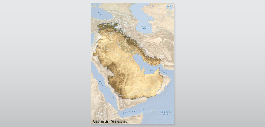
The present drainage network of the region is a relic of the distant past and a consequence of fluctuating global sea levels. The geologic basin reached its present shape by the end of the Pliocene period (5.4–2.4 million years ago), when the water levels were about 150 metres higher than they are today. During the subsequent Pleistocene glacial period (1.8 million to about 10,000 years ago), sea levels dropped by at least 120 metres, resulting in the formation of marine terraces and sabkhas. During this wetter, cooler period, pluvial (rain-fed) lakes existed in internal basins that were drained by rivers that carved the landscape as they meandered into what was then a dry Arabian Gulf.
Today, and for the past 17,000 years, hyper-arid conditions prevail and not a single watercourse reaches the sea throughout the year. Past events have had major effects on today's composition and distribution of fresh water in the region.


