


Ecology of Water
Ecology of Water
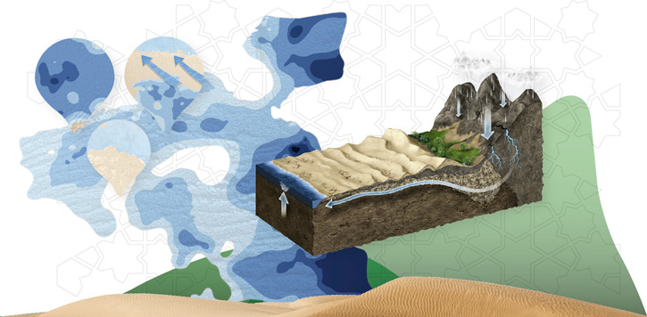
The ecology of water resources in Abu Dhabi is complex and fragile. With negligible rainfall, there is almost no persistent surface water in the Emirate, and most of the fresh water sources lie underground in complex layers of permeable rock and various sedimentary deposits. There is plenty of seawater, but this requires a large amount of energy to make it useful for most human uses. Today, man's activities have a fundamental impact on this ecology, and demand for more water has far exceeded the natural supply.
Sub-surface Hydrogeology
Over millions of years, the land beneath the present day Emirate formed a large basin which, for long periods, was covered by a shallow sea and, at other times, exposed above sea level. While covered by the sea, minerals from the shells of billions of marine creatures were deposited forming limestone, in addition to sands, silts and mud-clays swept in by tides. During periods above sea level, ancient streams and rivers deposited further layers of gravels, sands, silt and clay. Over millennia, thousands of metres and multiple layers of sediments accumulated. Today, these water-bearing permeable rocks and unconsolidated materials at different depths form a widespread, inter-connected network of aquifers and reservoirs that transport and store the Emirate's precious groundwater resources.
Across the Emirate, groundwater movement is generally from east to west although north of the Liwa Crescent, higher groundwater levels produce flows to the south across the border into Saudi Arabia. The recharge of the Emirate's aquifers is highly variable over time and location, and directly related to the periodic and unreliable rainfall patterns across the region. Between 6,000 and 9,000 years ago, the area was far wetter with recharge rates that supported vast reservoirs of groundwater as well as lakes on the surface. It is remarkable to think that large quantities of water that fell as rain many thousands of years ago still move through the Emirate's aquifers providing an essential and life-sustaining resource today.
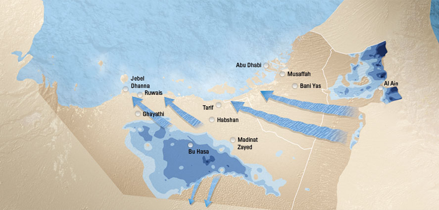
Western Region
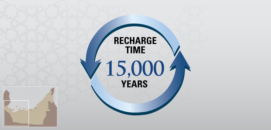
The Emirate is divided into two primary hydrogeological regions. The Western (Al Gharbia) Region includes the Rub' al-Khali basin that Abu Dhabi shares with Saudi Arabia. The geology consists of gentle folds of rock layers, including limestone that has been fractured by earth movements to produce intricate multi-aquifer systems. There is very little rainfall in this region, and discharge water from inland sabkhas results in shallow intermediate aquifers where water is stored in thin layers of sand. In this area, the regional groundwater systems are highly mineralised and warm since the water may reside underground for as long as 15,000 years. This slow moving, ‘fossil' water is discharged in the low-lying sabkhas along the Gulf coast and Saudi Arabia. The very slow movement and longer time under-ground causes the groundwater to accumulate a large amount of dissolved salts, resulting in hyper-saline groundwater.
Eastern Region
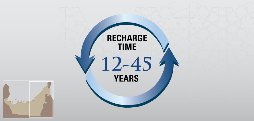
The Eastern Region is underlain by the eastern edge of the Arabian Continental Shelf and what is called the Oman Mountain Foredeep. Local systems in this region near the Omani border include natural springs and supply water that has appeared traditionally in shallow hand-dug wells and aflaj irrigation systems. This cool, fresh groundwater is regularly recharged by rainfall in the nearby Hajar mountains and spends a relatively short time under-ground of between twelve to forty-five years. This system has sustained the famous oasis of Al Ain and surrounding date farms and gardens for many generations.
Gradual and Accelerating Decline
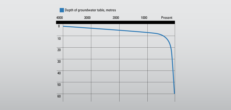
The long-term trends in groundwater levels have been derived from archaeological studies of climate change in the Hili area of Al Ain. Estimated groundwater levels show only a very slow decline from 2,500 BC to about 1,650 AD. However, a dramatic rate of decline is most obvious from the beginning of the last century. This coincides with an increase in local population and the resulting exponential growth in demand for water, especially for irrigation purposes. This caused a precipitous lowering of the depth of the water table and a resulting decline in water availability.


