Movement of the Arabian Plate in relation to the surrounding tectonic plates generates pressure and heat, exerting immense force on the sub-surface rocks of the region. Under such persistent and enormous stresses, sub-surface rocks may respond by breaking or ‘faulting.' Once faults have developed, these zones of weakness may become earthquake zones. Earthquake epicentres occur mostly to the north in the Arabian Gulf and Iran.
The ongoing compression of the Zagros Range causes frequent but relatively weak earthquakes in the region. Occasional large movements along vertical linear faults, such as the north–south trending Nayband Fault in south-east Iran, are usually accompanied by powerful and devastating earthquakes that can sometimes be felt across the Gulf.
A south-west branch of this fault lies beneath Dibba in the north-east Emirates but probably does not extend into Abu Dhabi.
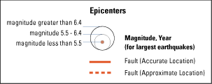
The earthquakes shown on this map are expressed as magnitudes on the Richter scale. This logarithmic scale measures the relative intensity of an earthquake. The Richter scale expresses magnitude in whole numbers and decimal fractions. A magnitude 5.3 earthquake would be rated as a moderate earthquake, while a magnitude 6.3 would be rated as a strong earthquake. Given it is a logarithmic scale, each whole number increase in magnitude represents a ten-fold increase in earthquake amplitude or intensity.