


Earliest Origin
Plate Tectonics
The Earth's crust is divided into a series of plates that continually move relative to each other. This process is called Plate Tectonics. Over geological time, the movement of the plates has uplifted the crust locally, warping, crushing and fracturing it into mountains and other landforms that mark the zones of collision and landscape formation.
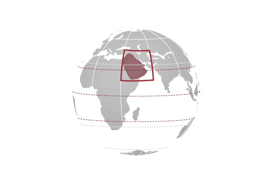
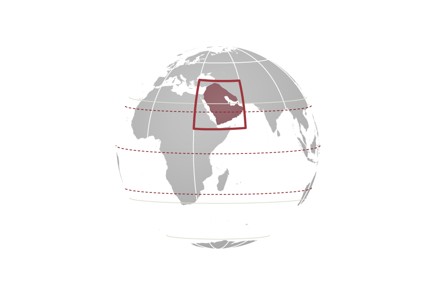
The physical geography of Abu Dhabi today displays the consequences of such dramatic movements, which still continue – the Emirate islocated close to an active plate boundary between the relatively small Arabian Plate and the massive Eurasian Plate.
Amazing Journey
Dramatic Beginnings
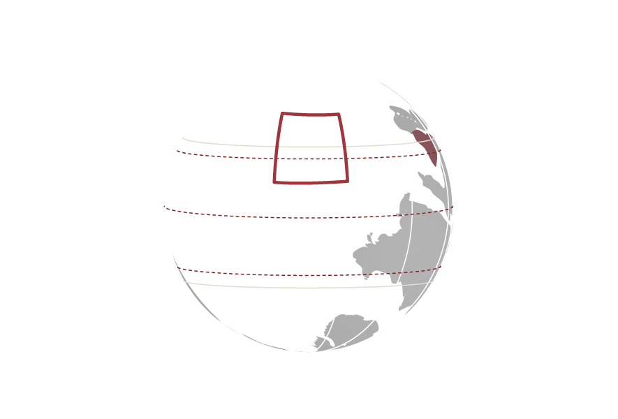
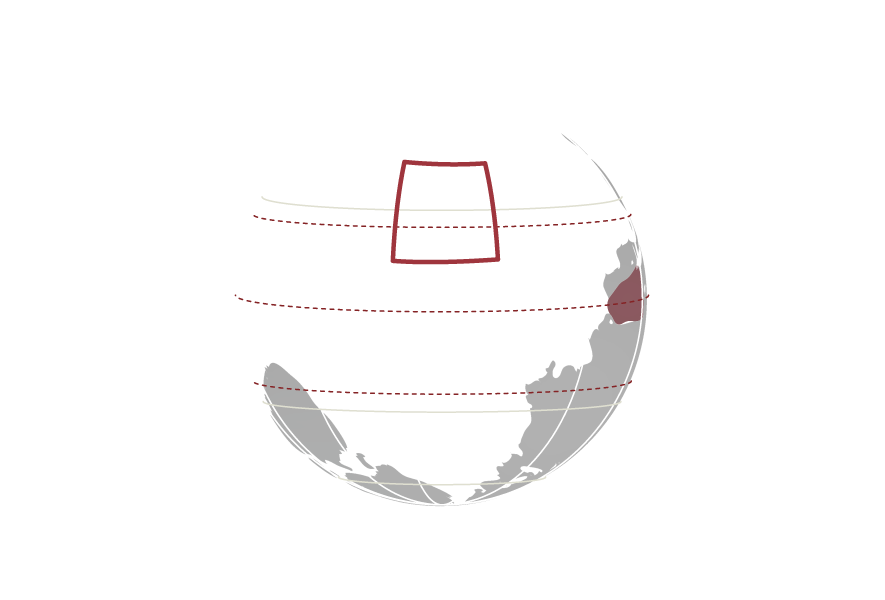
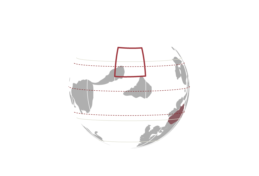
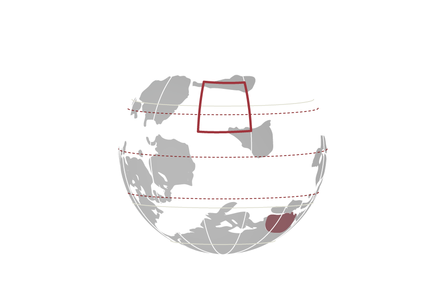
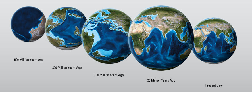
Abu Dhabi and the rest of the UAE is located on the Arabian Plate, once part of the ancient supercontinent known as Gondwana. Evidence of its geological history can be traced with some certainty to about 950 million years ago. Subsequently, the Arabian Plate underwent periods when it was partially submerged below the sea, acquiring marine sediments (creating rocks such as sandstones and limestones), or exposed above the surface and subjected to erosive forces that deposited fluvial (river origins), lacustrine (lake origins) or aeolian (wind-blown) sediments. These diverse episodes are recorded within the sub-surface rocks and geological formations of the the Emirate.
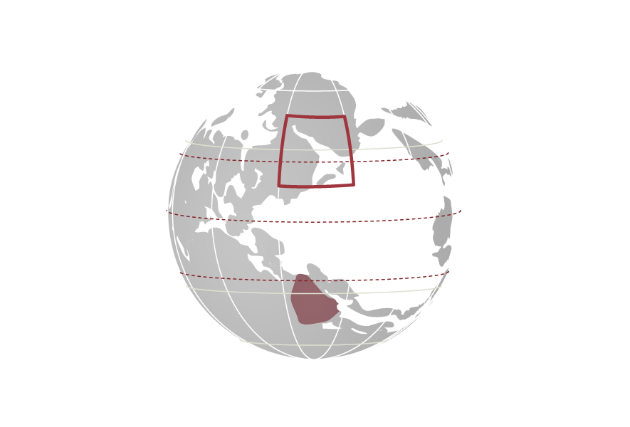
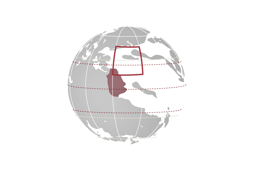
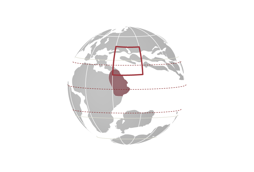
Throughout the Palaeozoic era (542– 251 million years ago), the Arabian Plate, and the whole of Gondwana, was located in the southern hemisphere. Furthermore, in the early Paleozoic the Arabian Plate was actually oriented 90° counter clockwise relative to today's poles. However, under the influence of plate tectonics, Gondwana moved across the South Pole, migrating to the other side of the planet. It eventually emerged the ‘right way up', with the land mass that included the Arabian Plate oriented more or less as we see it today. This southerly journey crossed largely temperate latitudes; consequently most of the rocks formed at that time comprised sandstones and shales.
A small outcrop of these 450 million year old rocks is seen today at Jebel Ra'an in the Hajar Mountains of Ra's al Khaimah Emirate. However, the route of this epic journey by the gigantic land mass changed dramatically between 260 million years ago (the Late Permian) and 5 to 10 million years ago (the Late Miocene). During this period, the Arabian Plate drifted northwards through the tropics where warm, shallow seas were ideal for the accumulation of thick beds of sediments through a process known as sedimentation, which had lasting and significant impacts on the regional geology.
Secrets of Sedimentation
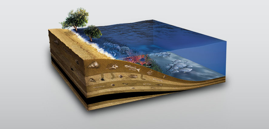
Sedimentation usually occurs in low lying areas such as oceans, where successive layers gradually accumulate. These originate from sands carried by rivers or blown by the wind, mud and marine sands and the remnants of dead organisms such as molluscs. As their thickness increases, the layers (strata) are compressed by the overlying weight.
This crushing and the presence of mineral fluids cements the sediments to form rocks. These rocks record the detailed geological and environmental history of where they were deposited. The process also contributed to the formation of the extensive oil and gas deposits across the region.


